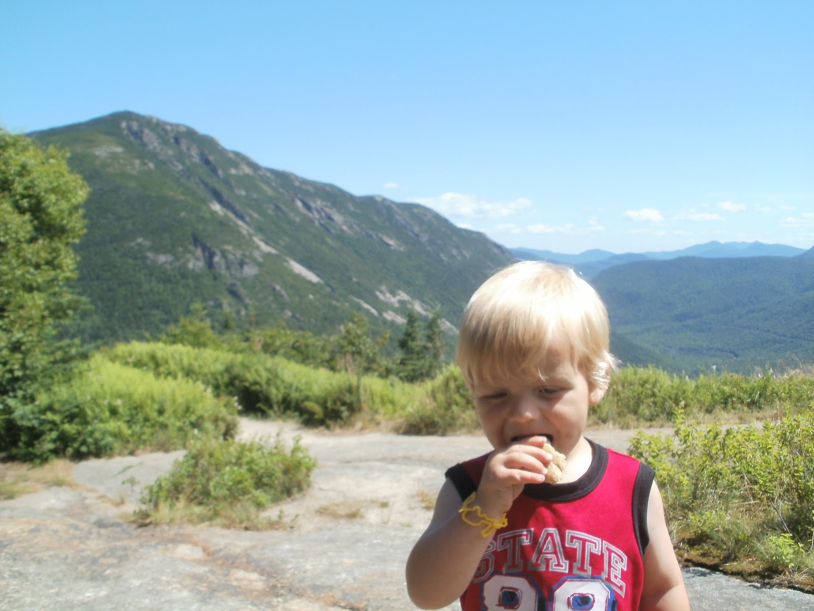
I was looking for a hike with an interesting and unique feature as opposed to just a summit for the sake of a summit, which is what we were doing much of last summer, and chose Mts. Morgan and Percival due to their "caves" up near the respective summits. I last hiked these mountains maybe 10 years ago and thought Alex would enjoy them. Weather was perfect, a bit hot, but hot is better than wet.
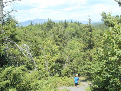
We got a late start and didn't start hiking until almost 11:00 but this is a short hike so I wasn't worried about time. We were doing the loop clockwise as I figured it would be easier ascending the ladders on Mt. Morgan rather than descending. There were some hiking sticks at the trailhead that someone left there and Alex wanted one so he grabbed one, made me grabbed one and then pretended he was a jedi all the way up the trail. He has had a recent interest in Star Wars to put it mildly!
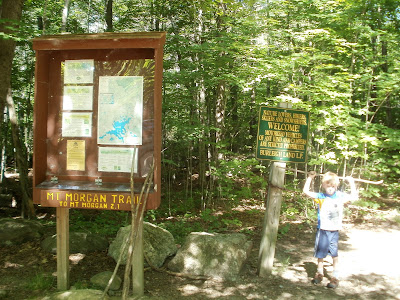 |
| Alex at the trail head. |
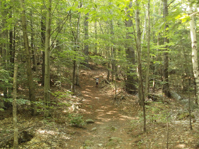
The trail starts out pretty flat and easy and continues that way just about all the way up. Trail was very dry and in good shape. Quite a bit of work has been done recently I would say clearing some VERY loarge blowdowns. Could see the sawdust from the chainsaws. Many trees a good 1-2 feet in diameter had fallen and had to be cut up to clear the way. The trail does get steeper near the summit, but certainly a relaxing change from some of the higher peaks north!
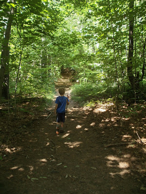 |
| Alex heading up the trail with his "light saber" |
 |
| We thought this looked like a pig's head |
 |
| Taking a break |
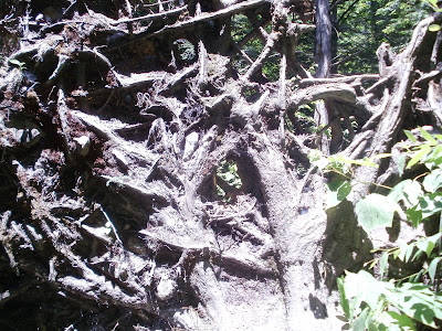 |
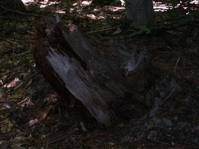
| Back side of one of the blowdowns, Alex thought it was neat and snapped this picture of the web of roots. |
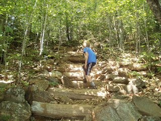 |
| A litter steeper now, lots of rock steps. |
Alex was having a tough time for the first bit, and almost wanted to turn around several times. We were very very slow going, ended up eating most of the snacks and lunch long before we got to the base of the ladders. He was getting real tired and I didn't think we were going to make it. But we kept chugging as I promised him the caves would be cool and he'd be very glad he finished. So we kept on (and I was hoping I remembered things correctly from last time I went this way!)
Well we made it to the base of the ladders and boy was Alex excited when he saw them! We met a group coming down with a couple dogs and had to wait a while for them to get down.
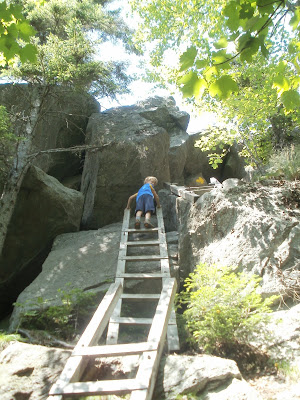
 |
| Alex at the base of the ladders |
|
Alex wanted a movie of him climbing the ladders so here ya go.
At the top of the 2nd ladder, Alex couldn't continue by himself.
 |
| Uh oh, "Daddy, help!" |
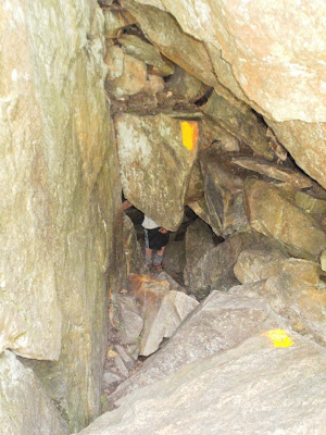
So I had to climb up and past and them pick him up to the 3rd, and off he scurried up that one and into the short cave.
 |
| Looking straight down from the top of the ladders |
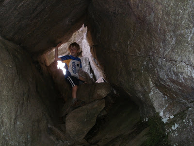 |
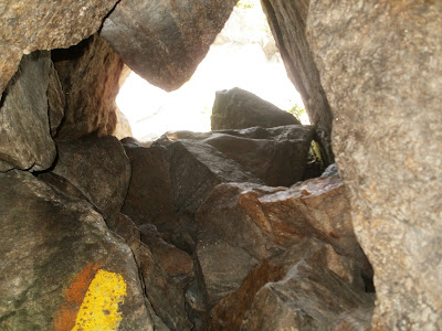
| Inside the cave |
 |
| Inside the cave |
Alex wanted another video of him climbing out of the cave and up so again, here ya go:
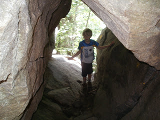
After climbing the ladders and going through the cave you climb out on top of some cliffs and get your first good view.
 |
| Looking west along the ridge to Mt. Webster (not the other Mt Webster I had to explain to Alex) |
 |
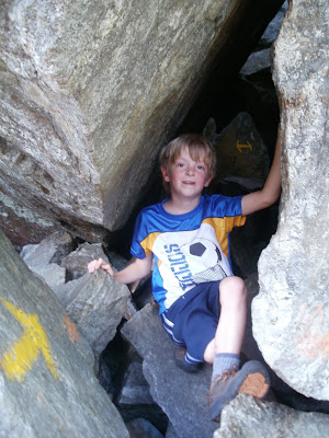
| Alex sitting just outside the cave |
After taking in the first view we continued up and around to the top of the cliffs. This is probably the first place Alex and I have hiked together where a fall would NOT have turned out to well. But I never felt we were in too much danger, I always made sure I had better than good footing and waited until he got up the 'difficult' parts and had a place to sit down before I came up after. So the pictures had to wait until after we got to the top, camera in the pocket! The last place I was at like this was at the ledges on Whiteface on Blueberry Ledge trail. I did those w/o Alex on very wet rocks and as I mentioned in that trip report, had I gotten there with Alex, we would NOT have gone up due to the wet rocks. These today were bone dry.
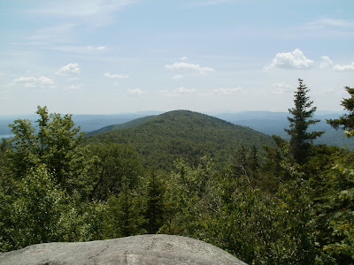
After climbing to the top we were rewarded with outstanding views of Squam Lake and mountains south. I am not sure of exactly which are what, but am pretty sure I picked out the Uncanoonucs near home (where I have been hiking several times a week on my way home from work for exercise) and to their west Joe English, so that puts our house in that general area. Pretty sure I spotted Mt. Monadnock as well.
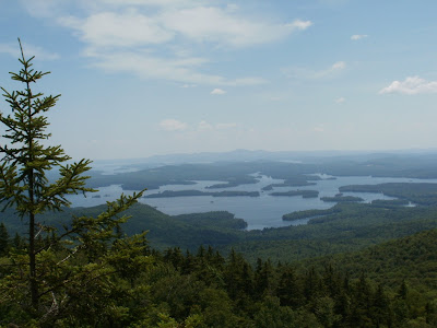 |
| Squam Lake and points south |
Since Alex was having a hard time on the way up and wanted to turn back a few times I let him decide if he wanted to turn back and head down or continue over to Mt. Percival and check out the caves over there. Well it was an easy and quick decision and off to Percival we went! This stretch went really fast as after experiencing the ladders, caves, and cliffs on Morgan Alex was off to the races!
We quickly took the spur to the true summit and saw some views north, Tecumseh I imagine. Along the way we heard a noise in the woods and Alex spotted a 2 foot long snake! Snapped some pictures and left him be.
 |
| sssssssssssss.... |
Before long we came to the summit of Mt. Percival with pretty much the same views as Morgan.
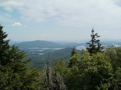 |
| Percival view |
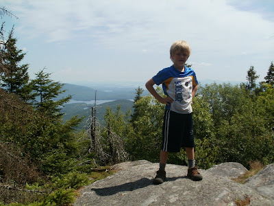 |
| Alex on Percival |
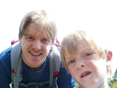 |
| Alex wanted to snap a picture of the 2 of us |
Hmmm, pictures are a little out of order. Oh well.
 |
| Alex heading down trail between Morgan and Percival |
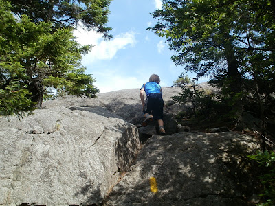 |
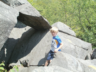
| Scramble up to Percival |
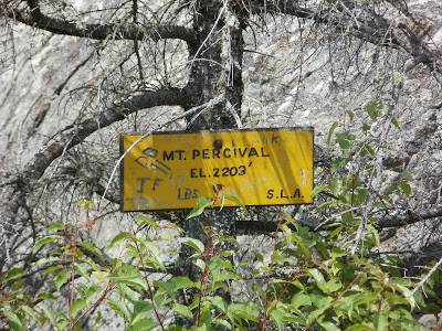 |
| Not a tall mountain as far as elevation, but elevation isn't all that always matters! |
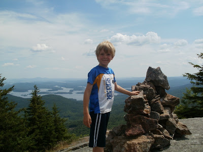 |
| Alex on Percival cairn |
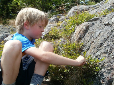
We didn't linger long on Percival, Alex was pshyced to get into the "spooky" cave. There were several trails leaving the summit and no signs but the trail guide described which was which so I went off memory and picked the one to the right (when looking south) and sure enough, that was the route through the caves. There were lots of blueberry bushes, just full of them! They got Alex's attention and he sat there for a while picking and eating blueberries. Earlier in the day I pulled up a fern and showed Alex the "Maine Bananas" that you can eat. I don't know what they are really called, but being from Maine, I was told they were "Maine Bananas". At the base of ferns if you pull them up you can fine a dozen or so one inch long things that are kind of shaped like a Banana. And if you eat them, they kinda taste like wood... Maybe they are not meant to be edible and it was some trick someone played on me when I was a kid! But hey, we ate some anyway. So anyway, here Alex was picking blueberries and said that if we were lost in the woods without food we could eat these. Absolutely! I told him. Then he said we could make blueberry muffins with them. I asked where we would get the mix out there in the wilderness while lost. "In our backpacks of course!" was the answer!
So after the blueberries, we headed into the spooky cave. So why was it "spooky"? in preparation of the hike I found pictures online of the caves to show Alex and he thought the Percival cave was spooky.
 |
| Picking blueberries |
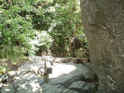
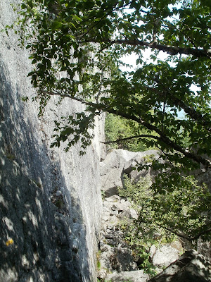 |
| Cliffs just above the cave |
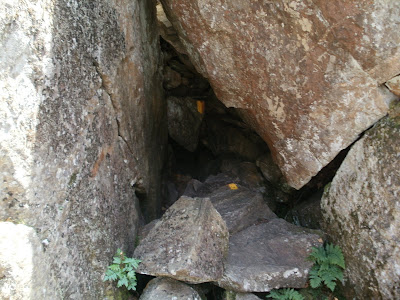 |
| Entrance to the cave, yes the trail goes in there as you can see from the yellow blazes |
The entrace was so small I had to send Alex in first, take off my backpack and hand it to him. Then I had to go down backwards and scrape my back on the rock above, and my belly below! Kind of like navigating some of the Lost River caves.
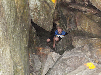 |
| Alex inside the cave. |
 |
| Alex behind the first rock, stand up inside. |
 |
| I made it in, looking back up and out |
The exit is also small, large inside but entrance and exit were small. I had to pass my backpack out again and climb out before putting it back on.
 |
| Tiny exit as well! note the yellow arrows pointing the way |
After the caves the trail down is much more rocky and seemed more steep than Morgan. But Alex was screaming down. In fact, the complete opposite as how the trip started. He was going so fast that I was just about going at my typical solo pace and the only thing that slowed us down is when Alex would find something interesting (a rock, a mushroom, a frog) and stopped to investigate.
 |
| Alex coming down the trail |
We took the side trail back to the Mt. Morgan trailhead and along the way came to a bridge that is in need of some repair! The railing is gone and one of the beams has broken and fallen. Alex wanted to go across anyway so using his balance he did. The stream had no trickle so the broken bridge over the dry stream wasn't really needed.
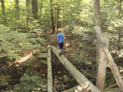 |
| Broken bridge, dry brook |
We finished about 5.5 hours after we started and after some tough goings at first we got to explore some ladders, caves, cliffs and rock scrambles, saw a snake a toad and other critters, took in some great views and had a great day. We finished up with Pizza in Ashland and on the way home through Weare we found a fair. I have no idea what the fair was for but we stopped and partook int he festivities. Then some ice cream at Dodges just before they closed, petted the animals and made i home 12 hours after we left (oh and at least an hour+ after bedtime)